GRASKOP HISTORY AND GENERAL INFORMATION
Graskop's , written history began in 1843, with the arrival of the Voortrekkers. In 1838 Louis Trichardt who had left to search for a port which was not under the control of tha British, reached Delagoa Bay. This journey caused the loss of many lives due to fever, which was in all probability, malaria.
In 1843 Andries Potgieter - who had just founded Potchefstroom - took a more southerly route, which turned out to be virtually impossible.. After struggling through what is now known as CASPERSNEK PASS (named after Paul Kruger's father who pioneered this oldest existing road in the region still in use) the party reached the edge of the Great Drakensberg Escarpment, to discover that there was no way down!
Leaving the women & children and a few men outspanned on the banks of the river just below the top of the escarpment - with strict instructions that the waiting group return to Potchefstroom if the scouting group had not returned by a date two months into the future - the men went in search of a way down to the Lowveld 1000m below. They discovered the way to the Lowveld via an animal track, on land under the control of a local chief named Koveni. Here the men were delayed.
The women and children waited a fortnight longer than instructed and then left banks of the river where they had been encamped. They anmed it the "Treurrivier" , which means "River of Sorrow. A few days later the returning men caught up with their womenfolk on the banks of another river, which was promptly named "Blyderivier"- River of Joy.
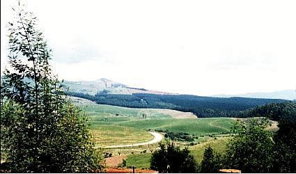
In the 1850's the farm GRASKOP - so named because of the vast tracts of grassveld and singular lack of trees in the area! - was owned by one Abel Erasmus who in later years was to become "native commissioner and magistrate" for the entire escarpment and Lowveld region. The local, indigenous people gave this redoubtable hunter the name "Dubula Duzi" in recognition of the fact that he waited till the very last moment before firing on his prey. (Dubula Duzi" means "He who fires/ shoots from close by.")
Gold was discovered in various places all over the region in the 1870's and the GRASKOP area was no exception. Though never as dramatic or as lucrative as elsewhere in the region - the watchful eye may still notice the scars of long - and not so long! - past mining operations around GRASKOP. There is, in fact, a working mine between GRASKOP and Pilgrims Rest (unfortunately "no visitors") and, as recently as 1996, the last of the prospecting "characters" in the region decided to hang up his pan. For those with a spirit of adventure, the money in the bank, lots of time, and the tenacity to go through the process of applying for a prospectors licence; every now and again one of the holders of the many gold claims in the region put their claims in the market.
"Jock of the Bushveld" belongs to the late 1880's and the early 1890's. Two chapters of this classic African tale - namely "Paradise Camp" and "Baboons and Tiger" - took place a stone's throw away from where the town of GRASKOP now stands.
By the 1890's, the need for a more cost effective route for necessities at Pilgrims Rest - in particular - allowed Max Carl Gustav Leibenitz to make his own fortune. Almost single-handedly this man turned the existing animal track into the first "Kowyn's Pass" - the present one is the third and was completed in 1957 at a gradient of one in fourteen.
The original pass had a gradient of - in some places one in three, and at the top of the pass Leibnitz built a toll gate and an inn. This in was the first permanent structure to be built in the GRASKOP environs. (The ruins of the inn and part of the original Kowyn's Pass are presently being looked at by GRASKOP C.T.O. as a possible future historical trail.)
Leibnitz' original pass could not - by the wildest stretch of the imagination - be termed a "road". The ascent was a 2 to 3 day grind of sweat, hard work and foul language. The heavier wagons required three spans of oxen to get up the steeper sections of the pass. Going down the pass was no game either because huge branches had to be attached to the wagon to assist with braking.
Needles to say the trade in liquor was very brisk indeed - even though Leibnitz did not have a licence. This fact, as such, wasn't a problem; but when the magistrate from Lydenburg passed through every second month on his way to the Lowveld, liquor was hastily hidden and there were many irate, thirsty men mumbling themselves to sleep.
On one auspicious occasion the magistrate - who was aware of the "illegal" trade and didn't mind the odd tipple himself - pointedly asked Liebnitz why he didn't sell liquor. "Who will look after the tollgate while I'm gone for a week fetching a piece of paper?" came the arch reply. At the truth and logic of this the magistrate relented and handed over the necessary forms, which were duly signed and witnessed. History doesn't record whether the first "Happy Hour" in GRASKOP's history happened before GRASKOP was even a town!
As the new century wore on it became obvious that an alternative to the expensive transport involving transport-riders, feed, tolls and wagons etc. was required. A railway spur from Nelspruit, through Sabie and onto " the farm GRASKOP" was begun early in 1910. This railway line was completed and ready for the opening ceremony on 18th June 1914. Excerpts from the "S.A. RAILWAYS AND HARBOURS MAGAZINE" of June 1914 (reprinted with kind permission of THE TRANSNET HERITAGE FOUNDATION LIBRARY). "The line is a branch from Nelspruit to .. Graskop farm, situated about 9 miles (14,5 km) from Pilgrims Rest and 20 miles (32 km) from Sabie. The present terminus is a spot on an open veld with not half-a dozen houses within a radius of 3 miles (5 km), but round which is proposed to form a government township. All Pilgrims Rest wended their way down to the railway station, where the first train was to arrive at 2.30, but owing to delays, it did not steam in until 3.15. It was wonderful how the crowd of some two hundred persons managed to get out, for, owing to roads not being completed it took two and a quarter hours for the town to drive out from Pilgrims Rest. The station was prettily decorated with flags, and the scene was pretty and full of life."
GRASKOP was declared a township later in the year.
By 1918 Graskop had a primary school, a church and a store. Talk of the town becoming a farming community was just that. Talk.
Because of the high rainfall, vegetable and fruit farming was not a viable enterprise due to the fact that the cost of fertilizer (and its transport) for that kind of farming made it to be non-profitable.
Although there had been cattle around for some time, the predominantly sour-grass nature of the veld - which - which the cattle preferred not to eat - as well as the permanently wet nature of the veld - which caused hoof rot - nipped in the bud any idea of cattle or dairy farming on a large scale.
As a result of these factors, Graskop remained predinantly a railway town. Then, in the late 1920's and the early 1930's came the depression.
In an attempt to give as many people as possible a way of making a living, the government of the day decided to plant trees in the region. Trees were always going to be planted here, but this decision turned a fifty year plan into a five year plan as thousands of white men planted the first trees by hand and received a pittance for their labour. That pittance, however, kept many thousands of loved ones from starving in those dark days. Since the depression and after the first cutting of the trees (as a matter of interest and as a rule of thumb, the trees in the region only grow fifteen years before they are felled) Graskop became a timber town with a little more prosperity than before.
By the time the Second World War started Graskop had a population of approximately 700 people. The town hall had been built and there was a golf course and a horse racing track, (no trace of either is now left!) as well as a branch of the regional newspaper named the "Sabie and Pilgrims Rest News", and a bank.
But the one thing that never changed was the steady stream of tourists who were entranced by the region. Although it was as rough as it could come on the gravel roads of twenty five years ago, many people came and were conquered by the (then unspoiled) splendours which abound, despite the fact that the roads were virtually impassable in the rainy season and so dust filled during the dry winter months that one had to keep one's distance from the vehicle in front, or drive in a perpetual talc-like cloud.
At that time Bourke's Luck Potholes - already a prominent tourist attraction! - was spanned by swing bridges and the trip to the 3 Rondawel Viewpoint was an overnight affair.
Many residents of the region are the offspring of men who found that they could - or would? - not exist outside of the "encircling comfort of these hills" (as one elderly resident would have it). This "encircling comfort of these hills" attracts many hundreds of thousands of people to the Greater Escarpment Tourist region every year, and a goodly proportion of these persons are returnees.
The presence of prehistoric man is confirmed by discoveries of stone implements from the Middle Stone Age, 50 to 100 thousand years ago.
Remains of stonewalls belonging to an extensive settlement in the Kadishi Valley probably date back to the Iron Age between the 7th and 19th centuries.
Monochromatic rock paintings indicate that the earliest Bushmen also lived in the Canyon. A number of battles between local Mapulana and invading Swazi Impi's form part of the early history of the area. The final battle took place around Mariepskop, named after the Chief who led the Mapulana's to victory around the mountain.
Commandant AH Potgieter led a reconnaissance expedition from Potchefstroom in 1840 to investigate the possibility of a trade route to Delagoa Bay. This party renamed the Treur and Blyde rivers. The discovery of God at Pilgrims Rest in the 1870's caused an influx of diggers to populate the nearby mountains and valleys. Bourke's Luck was named after Tom Bourke who recognized the god potential of the area. He became involved in the mining enterprise, which owned the property, but never found a personal fortune.
The Belvedere hydroelectric power station situated at the confluence of the Belvedere stream and the Blyde River, was the largest of its kind in the Southern Hemisphere at the time of its installation in 1910. It operated until 1972.